Iceland remains one of the most sparsely populated nations on earth, home to fewer than four hundred thousand residents spread across an expansive volcanic island roughly the size of Ireland or Cuba. Extreme glacial geology, jagged fjords, and active volcanic zones concentrate nearly two-thirds of the islanders within the southwestern capital territory, leaving vast tracts of the highlands completely uninhabited. According to demographic registers compiled by Statistics Iceland, urban settlements outside the primary municipal orbit often count their populations in modest thousands rather than hundreds of thousands.
Life across these peripheral communities revolves around historic fishing harbors, geothermal agricultural projects, and seasonal tourism corridors. Living along active tectonic boundaries shapes municipal infrastructure in unique ways, with piping transporting boiling volcanic runoff directly beneath asphalt roadbeds and regional ports maintaining heavy maritime fleets through harsh subarctic winters. Examining the country by municipal size reveals how isolated outposts develop specialized identities along the North Atlantic rim.
10. Egilsstadir (approx. 2,600 residents)
Positioned on the banks of the serene Lagarfljot lake, Egilsstadir acts as the undisputed commercial and transportation hub of East Iceland. The town developed comparatively late in the mid-twentieth century, quickly evolving into an essential crossroad where the national Ring Road intersects the mountain routes heading into remote eastern fjords. Local folklore maintains that the deep, silt-laden waters of the adjacent lake harbor the Lagarfljot Wyrm, a mythical serpentine creature recorded in folk chronicles since the fourteenth century.
Beyond regional administrative bureaus, Egilsstadir anchors the inland agricultural district of the Fljotsdalsherad basin. The surrounding valley benefits from a mild inland summer climate, fostering Iceland’s largest managed forest reserve at Hallormsstadur. Travelers and logistics haulers frequently use the community as a base for exploring wilderness plateaus, distant wilderness shelters, and the rugged coastline of the eastern fjords.
9. Isafjordur (approx. 2,900 residents)
Isafjordur occupies a flat, curved spit of land projecting into the waters of Skutulsfjordur, surrounded on all sides by towering basalt plateaus in the remote Westfjords. Settled as a trading post in the sixteenth century, the town preserves some of the oldest timber-framed buildings in Iceland, originally erected by Danish merchants. High mountains block direct sunlight from reaching the valley floor for several weeks during midwinter, creating a distinct seasonal rhythm celebrated annually by townspeople during the traditional Sun Day festival.
The local economy has historically depended upon commercial cod and haddock fisheries, complemented in recent years by university-level coastal management research centers. Given its geographic position at the tip of the northwest peninsula, the harbor serves as the primary departure point for expeditions into the trackless wilderness of the Hornstrandir Nature Reserve.
8. Hveragerdi (approx. 3,600 residents)
Situated forty-five kilometers southeast of the capital, Hveragerdi is known across the country for its intense subterranean geothermal energy. Natural fissures and boiling mud pots puncture public parks, back gardens, and sidewalk verges throughout the municipality. Residents harness this geothermal warmth to power extensive greenhouse complexes, allowing the town to produce domestic tomatoes, cucumbers, and decorative flowers regardless of harsh subpolar weather.
The Reykjadalur valley trail originates just above the town limits, leading hikers into a rugged volcanic gorge where boiling runoff merges with cold streams to create natural thermal bathing currents. In recent decades, expanded highway links have made Hveragerdi an appealing bedroom community for professionals working in Reykjavik while seeking quiet surroundings in southern Iceland.
7. Grindavik (approx. 3,600 residents)
Grindavik occupies a barren lava coast along the southern flank of the Reykjanes Peninsula, traditionally known as one of Iceland’s most productive fishing ports. The village grew around a sheltered natural harbor that granted fishing vessels immediate access to fertile North Atlantic fishing grounds. Its proximity to the world-renowned Blue Lagoon geothermal spa, situated in the neighboring Svartsengi lava field, established Grindavik as a primary tourism stop.
Beginning in late 2023, repeated volcanic eruptions and surface ground fractures along the adjacent Sundhnukur crater row disrupted civic life, triggering extensive temporary evacuations and protective defensive barrier construction. Despite significant geological disruption, civil authorities and fishing operators remain committed to stabilizing port operations and supporting local harbor industries along the peninsula.
6. Vestmannaeyjar (approx. 4,500 residents)
Vestmannaeyjar encompasses the populated town situated on Heimaey, the largest and only inhabited island in the Westman Islands archipelago off the southern coast. In January 1973, an unexpected fissure opened on the edge of town, creating the Eldfell volcanic cone and burying hundreds of homes under deep layers of volcanic ash and advancing basalt lava. A coordinated civil effort managed to evacuate nearly the entire civilian populace by sea overnight without direct loss of life, while emergency crews pumped millions of tons of seawater onto the molten front to prevent the total destruction of the town harbor.
Today, the harbor remains among the most lucrative seafood hubs in the nation, exporting high-grade catches to European markets. Summer brings millions of Atlantic puffins to nest among the sheer sea cliffs, attracting ornithologists and eco-tourists from around the globe.
5. Akranes (approx. 8,500 residents)
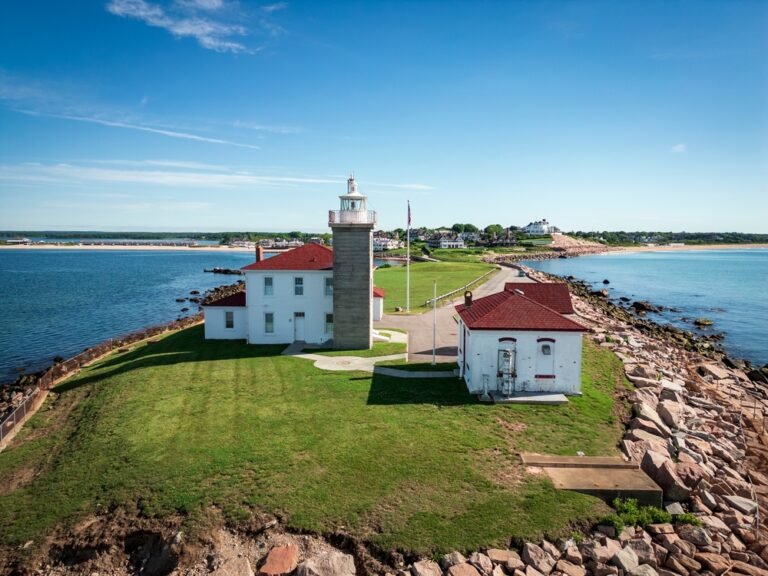
Sitting on a narrow western peninsula opposite Faxafloi bay from Reykjavik, Akranes developed around maritime commerce, ship repair yards, and industrial manufacturing. Two historic coastal lighthouses watch over the rocky shore, with the larger automated light serving as a venue for regional photographic exhibitions and acoustic concerts. The town’s industrial base broadened substantially during the mid-twentieth century with the construction of the national cement processing works.
Akranes also maintains an outsized reputation in national athletic history, producing celebrated football squads and national team athletes who earned dozens of league championships. Since the opening of the Hvalfjordur undersea tunnel eliminated an arduous journey around a deep fjord, commute times into Reykjavik dropped dramatically, encouraging residential expansion.
4. Selfoss (approx. 10,500 residents)
Selfoss straddles the banks of the turbid Olfusa river, carrying massive glacial runoff southward toward the Atlantic ocean. The community functions as the administrative and logistics nerve center of southern Iceland, anchoring regional dairy cooperatives and agricultural supply distribution. An iconic suspension bridge spans the river, forming an essential bottleneck along the southern segment of the national Ring Road.
In recent years, civic leaders launched an ambitious historic reconstruction of the urban center, rebuilding authentic replicas of historic wooden buildings from across Iceland to host cafes, boutiques, and culinary halls. Its position at the gateway to the Golden Circle ensures heavy daily traffic from travel buses, tour groups, and supply carriers year-round.
3. Akureyri (approx. 20,000 residents)
Frequently termed the capital of the north, Akureyri sits at the inland base of Eyjafjordur, the longest fjord in Iceland. Steep granite peaks rise directly behind the harbor, protecting the city against prevailing polar gales and giving it a surprisingly temperate summer microclimate. This sheltered setting permits the operation of the Akureyri Botanical Garden, housing thousands of plant varieties just fifty kilometers south of the Arctic Circle.
The city supports northern Iceland’s primary healthcare center, an international airport, and a flourishing university campus specializing in polar sciences and humanities. During winter, skiers flock to the slopes of nearby Mount Hlidarfjall, which offers extensive downhill trails overlooking the dark waters of the fjord.
2. Reykjanesbær (approx. 24,000 residents)
Formed through the administrative merger of Keflavik and Njardvik, Reykjanesbær represents Iceland’s second most populous municipal conglomerate. Located on the rocky coastline of the Reykjanes Peninsula, the municipality contains Keflavik International Airport, the primary aviation gateway welcoming millions of overseas travelers each year. The town grew rapidly following World War II, bolstered by civilian logistics operations supporting a substantial NATO airfield that operated until 2006.
Today, the community thrives on logistics facilities, data centers, and aeronautical support services. Its harborside districts feature museums celebrating local rock and roll heritage, maritime history, and the geological history of nearby volcanic rifts.
1. Reykjavik (approx. 249,000 residents)
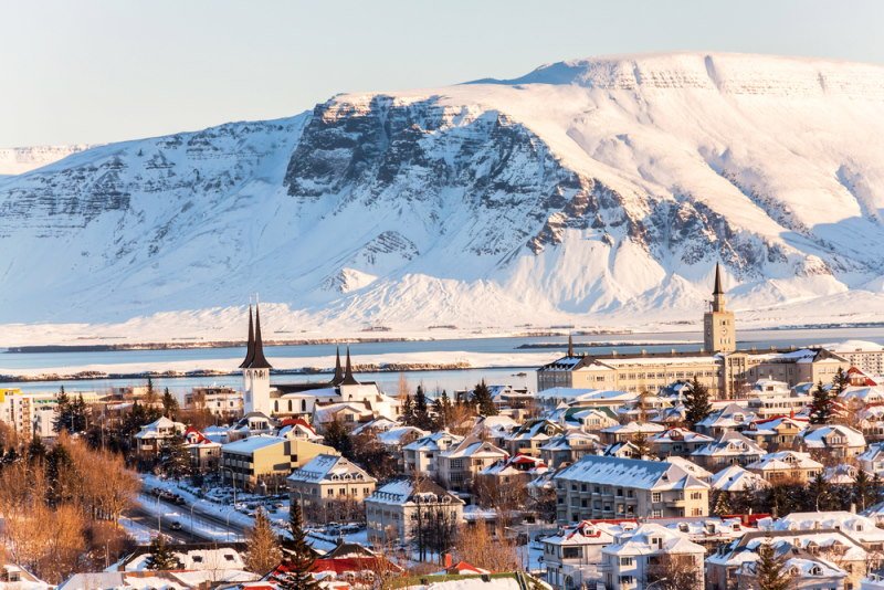
Reykjavik, meaning Smoky Bay in Old Norse, ranks as the northernmost national capital on earth and home to the overwhelming majority of Iceland’s economic and cultural life. The municipality itself houses approximately one hundred and forty thousand citizens, but the contiguous Greater Reykjavik area accommodates roughly a quarter million residents across interconnected suburban boroughs. Hallgrimskirkja, the towering basalt-inspired church designed by architect Gudjon Samuelsson, dominates the skyline and offers sweeping views of the surrounding bay and Mount Esja.
Urban life in the capital pairs clean streets and historic corrugated-iron houses with cutting-edge cultural landmarks, such as the glass-clad Harpa Concert Hall on the waterfront. Entire neighborhoods and municipal walkways benefit from extensive geothermal heating networks, which channel volcanic water directly beneath roads to prevent winter freezing and supply thermal energy to popular municipal swimming pools.
Conclusion
Iceland’s urban centers illustrate how human society adapts to volcanic forces, arctic weather, and geographic isolation. While Reykjavik stands as the modern epicenter of commerce and governance, coastal villages and regional outposts preserve authentic maritime traditions and provide essential lifelines across dramatic landscapes.